
Alum Cave Trail Highlights
- Trail Features
Views, Geological Features
- Trail Location
Newfound Gap Road
- Roundtrip Length
4.4 Miles
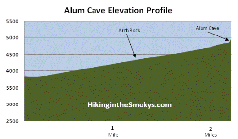
- Elevation Gain (total)
1,125 Feet
- Elevation Gain (per mile)
511 Feet
- Trail Difficulty
6.65
Moderately Difficult
This moderately difficult hike is 4.4 miles roundtrip and includes 1,125 feet of elevation gain.
Alum Cave Trail Description
The night before one of our hikes in the spring of 2008 a strong storm blew through the Smokies and dropped marble-sized hail, which still littered the trail the next morning. Guests returning from their stay at the LeConte Lodge the night before reported that the top of the mountain received nearly six inches of hail. They also related how they watched an incredible display of lightning below them, just before the storm moved up and over the mountain.
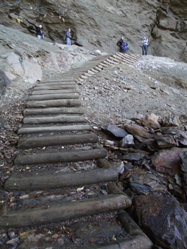
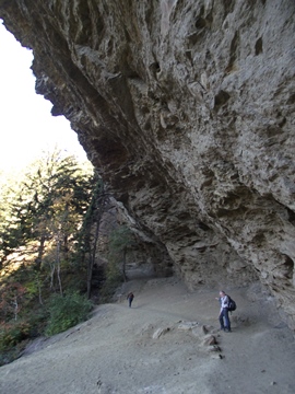
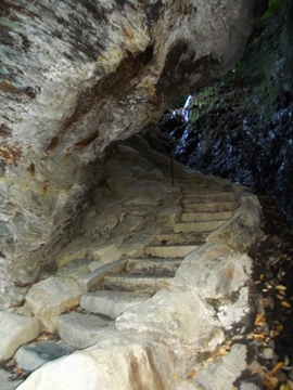
At just over 1.3 miles from the trailhead hikers will reach Arch Rock, the first prominent landmark along the trail. The arch was formed by freezing and thawing, which eroded away the softer rock from underneath the harder rock. The trail actually goes under the arch and requires a climb of several steps etched into the stone before exiting at the top.
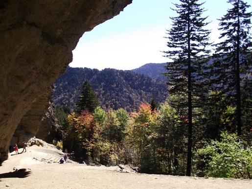
Beyond Arch Rock the trail begins ascending towards Alum Cave. Anakeesta Ridge will dominate the views on your left throughout this stretch of trail. At roughly two miles from the trailhead hikers will reach the appropriately named Inspiration Point, a heath bald that offers commanding views of Little Duck Hawk Ridge to the west and Myrtle Point (near the top of Mt. LeConte) towards the northeast. The Eye of the Needle, a hole in the rock near the top of Little Duck Hawk Ridge, can also be seen from this vantage point.
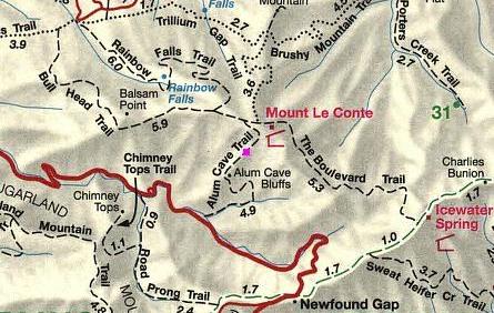
Alum Cave Trail Map
Alum Cave Elevation Profile
Directions to Trailhead:
The hike to Alum Cave in the Great Smoky Mountains begins from the Alum Cave Trailhead on Newfound Gap Road. From the Sugarlands Visitor Center near Gatlinburg, drive 8.7 miles south along Newfound Gap Road to reach the trailhead. The parking lot will be on your left. Due to the extreme popularity of the Alum Cave Trail there are two parking lots for this trailhead. To ensure a spot you may want to arrive early during peak tourist season, or on any nice weekend throughout the year.