Chestnut Top Trail Highlights
- Trail Features
Wildflowers, Views
- Trail Location
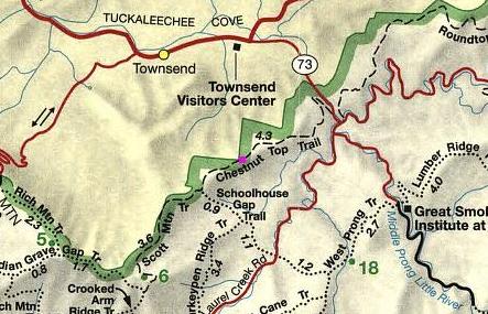
Townsend
- Roundtrip Length
8.6 Miles
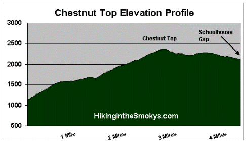
- Elevation Gain (total)
1486 Feet
- Elevation Gain (per mile)
346 Feet
- Trail Difficulty
11.57
Strenuous
This strenuous hike is 8.6 miles roundtrip and includes 1486 feet of elevation gain.
Chestnut Top Trail Description
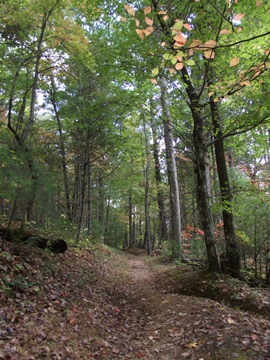
The first leg of the Chestnut Top Trail climbs steadily to gain almost 300 feet as it rises above the national park entrance road. Along this stretch you'll enjoy sporadic views of the mountains towards the east. If you look closely you may even notice the newest section of the Foothills Parkway high up in the mountains.
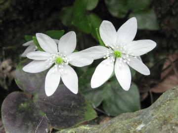
If you're hiking during the spring, take your time during this portion of the trail, as there will be many wildflowers to enjoy. During our late-March hike we noticed bloodroot, yellow trillium, hepatica and violets as we walked along this stretch of the trail.
In early March spring beauties are usually some of the first wildflowers to bloom along the Chestnut Top Trail. As the spring season progresses you may also find white trillium, Jack-in-the-pulpit, bishop's cap, purple phacelia, fire pink, plantain-leaved pussytoes, star chickweed and wild stonecrop. During the late spring and early summer period, look for hairy beard-tongue, rattlesnake hawkweed and squawroot. Many of these flowers can be found within the first couple hundred feet of the trailhead.
Roughly two-thirds of a mile from the trailhead, just after completing the initial climb, hikers will find an opening in the canopy at a sharp bend in the trail that offers some decent views of the Townsend and Tuckaleechee Cove areas towards the northwest. Unfortunately, dense foliage will completely obstruct this view during the summer months.
After making a sharp turn towards the left, the trail flattens out for a short distance, before it begins climbing towards Schoolhouse Gap along a ridge known as Chestnut Top Lead.
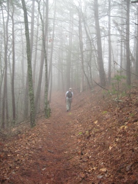
As you climb and crest the ridge you'll catch sporadic glimpses of Tuckaleechee Cove on your right, and the Smoky Mountains towards the left. Most of these vantage points are the result of storm blow-downs, and at least one forest fire. Unfortunately, on the day of our most recent hike, we ran into a fair amount of thick fog that blocked most of our views along this stretch.
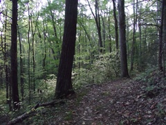
Most of the trail travels through a mixed forest, while fallen pine needles from spruce and fir trees provide a soft footing. At 4.3 miles the trail dead-ends at the Schoolhouse Gap Trail junction. This also marks the end point for this hike description.
Chestnut Top Trail Map
Chestnut Top Trail Elevation Profile
Directions to Trailhead:
The parking area for the Chestnut Top Trail is located roughly one hundred yards north of the Townsend "Y" on Route 73. The parking lot is on the east side of the road, while the trailhead is located directly across the street.