Cumberland Gap National Historic Park
Known as the first great gateway to the west, Cumberland Gap is a prominent V-shaped notch in the Cumberland Mountains that was used by wildlife, Native Indians, explorers, hunters and pioneers wishing to pass through the mountains. The Gap is situated on the Kentucky-Virginia boundary approximately one-quarter of a mile north of the point where Kentucky, Virginia, and Tennessee meet.
Dr. Thomas Walker of Albemarle County in Virginia is credited with discovering the pass in 1750 while searching for settlement sites beyond the mountains.
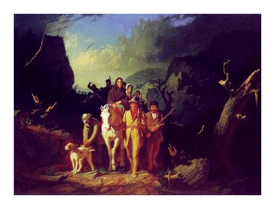 In 1775, Daniel Boone, along with 30 other men, were hired to blaze a trail, later known as the Wilderness Road, from Martin's Station (Rose Hill, VA) through Cumberland Gap. It would become the main artery for pioneer migration into the trans-Appalachian wilderness over the next 50 years.
In 1940 Cumberland Gap was designated as a National Historical Park, making it the largest unit of its kind at that time (Chaco Culture is now the largest).
Today the park stretches for 26 miles along Cumberland Mountain. It occupies roughly 24,000 acres along the Kentucky, Virginia, and Tennessee border, and contains roughly 85 miles of hiking trails, as well as numerous scenic and historic features. Ranger led programs are also offered throughout the year, which include tours of Gap Cave and the historic Hensley Settlement.
From the Visitor Center park visitors will have the opportunity to drive a winding four-mile-long road up to Pinnacle Overlook (elevation 2,440 feet), which offers spectacular views of the three surrounding states.
For most of the 20th century, U.S. Highway 25E cut a path across the Gap. However, after the completion of the Cumberland Gap Tunnel in 1996, the road was rerouted under the park. The National Park Service is in the process of restoring the original appearance of the Wilderness Road as it crosses the Cumberland Gap. Thousands of seedlings from original forest stocks in the area have been replanted with the intention, over a period of decades, to recreate a forest that will allow visitors to experience Cumberland Gap as travelers did in the late 18th century. This section of the Wilderness Road is now a hiking trail.
The park offers a variety of outdoor activities such as hiking, backpacking, camping, wildlife viewing, as well as many opportunities for experiencing history first hand, including pioneer settlements and Civil War artifacts.
The lush vegetation of Cumberland Gap supports a wide variety of wildlife, including white-tailed deer, black bears, bobcats, gray fox, rabbits, raccoons, opossum, gray squirrels, hawks, vultures and wild turkey. The annual autumn hawk migration is usually a spectacular event, and can be observed from numerous vantage points along the Ridge Trail, as well as from the Pinnacle Overlook.
Hiking in Cumberland Gap
Roughly 85 miles of hiking trails meander through the eastern deciduous forests of Cumberland Gap. Distances range from a 1/4-mile loop trail to the 21-mile-long Ridge Trail. Some of the most popular destinations in the park include the Hensley Settlement, White Rocks, Sand Cave and Tri-State Peak.
Hensley Settlement is a restored mountain community located atop Brush Mountain towards the eastern side of the park. Park guests can visit the chestnut-hewn cabins and learn about early pioneer life and the self-sufficient lifestyle of the Hensley and Gibbon families. Restored by the National Park Service, the Settlement is accessible by hiking, horseback, or a seasonal shuttle service offered by the park. The shortest hike to Hensley is a 9.2-mile roundtrip hike via the Shillalah Creek Trail on the Kentucky side.
Towering 3,500 feet above the valley floor is White Rocks, a massive limestone outcropping that offers breathtaking views into Virginia. The shortest hike to White Rocks is from Civic Park in Virginia, on the far eastern end of the national park.
Sand Cave is a 75-foot high sandstone overhang that's decorated by at least seven different colors of sand. In rainy seasons, a small waterfall cascades over the edge.
Cutting across the length of the park is the Ridge Trail. This is a moderate trail with many ups and downs that runs along the Virginia/Kentucky border. The trail connects to all the major park trails, to four primitive backcountry campgrounds, and provides access to the Hensley Settlement, Skylight Cave, Sand Cave, and White Rocks.
The table below shows the 11 trailheads that offer access to hiking trails in the park, and the mileage to the various destinations within the park.
Please note that the Chadwell Gap Trailhead off Rt. 688 near Caylor, VA was reopened in the spring of 2009 after being closed for eight years.
Pinnacle:
to Sugar Run 1.7
to Lewis Hollow Trail 1.7
to Gibson Gap Trail 5.1
to Indian Rock 10.5
to Hensley via Indian Rock 11.0
to Hensley via Ridge Trail 11.7
to Chadwell Gap 12.4
to Martin's Fork Cabin 12.6
to Chadwell Gap Trail 12.8
to Ewing Trail 15.6
to Sand Cave Trail 15.8
to White Rocks Campground Trail 16.5
to White Rocks 16.6
to Civic Park 19.0
Civic Park:
to Ridge Trail 3.8
to Sand Cave Trail 4.0
to White Rocks Campground Trail 3.0
to White Rocks 3.2
to Martin's Fork 7.2
to Hensley Settlement 8.0
Shillalah Creek:
to Hensley Settlement 4.6
Wilderness Road Campground:
to Gibson Gap Trail 4.8
to Honey Tree Spur 1.1
to Green Leaf Nature Trail 0.1
Wilderness Road/Mischa Mokwa:
to Ewing Trail 21.0
Wilderness Road Picnic Area:
to Skylight Cave 0.6
to Ridge Trail 1.1
to Pinnacle 2.8
Highway 988 via Sugar Run:
to Ridge Trail 2.2
to Pinnacle 3.9
Visitor Center:
to Fitness Trail 2.0
to Bike Trail 1.0
Iron Furnace/Wilderness Road:
to Wilderness Road 0.3
to Saddle of the Gap 0.6
to Tri-State Peak 1.2
Thomas Walker Parking Lot/ Wilderness Road Trailhead:
to Saddle of the Gap 1.1
Thomas Walker Parking Lot/Object Lesson Road Trailhead:
to Wilderness Road 0.4
to Saddle of the Gap 0.6
to Tri-State Peak 1.2
Key Links:
Cumberland Gap National Historic Park
Cumberland Gap Hiking and Camping Information
Cumberland Gap Trail Map (10.1 mb PDF File)