Juney Whank Falls Highlights
- Trail Features
Waterfalls
- Trail Location
Deep Creek
- Roundtrip Length
0.5 Miles
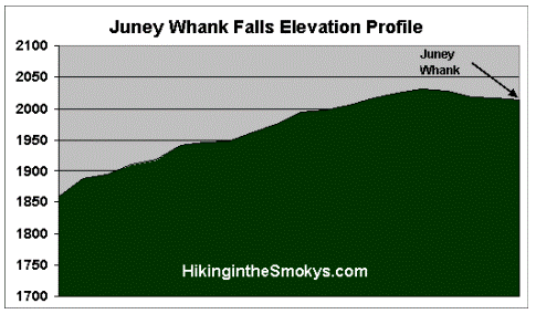
- Elevation Gain (total)
194 Feet
- Elevation Gain (per mile)
776 Feet
- Trail Difficulty
0.89
Easy
This easy hike is 0.5 miles roundtrip and includes 194 feet of elevation gain.
Juney Whank Falls Description
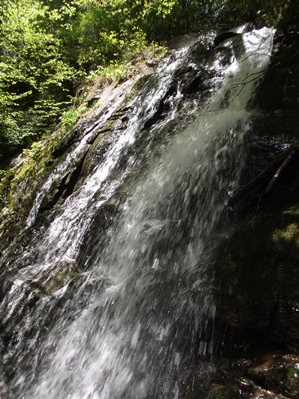
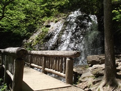
Juney Whank Falls is located only a quarter-of-a-mile from the parking lot. Although a short hike, the 194-foot climb to the viewing area is relatively steep. The trail leads to a footbridge that provides an juney whank fallsup-close view of the falls. The 80-foot cascade begins its descent just above the footbridge, before running underneath it and eventually emptying into Deep Creek at the bottom of the trail.
The stream and the falls are more than likely named for Junaluska "Juney" Whank, a man who is said to be buried in the area. However, there are some people who believe Juney Whank is a Cherokee phrase that means "where the bear passes".
For anyone interested in some additional hiking while in the Deep Creek area, you will have a couple of options. Both Toms Branch Falls and Indian Creek Falls are short easy hikes, and are both accessed from the same parking lot as the Juney Whank Falls Trail. Hikers will also have the option of continuing on this same trail, which will create a loop that visits all three falls in this area.
Horace Kephart, an early proponent of national park status for the Great Smoky Mountains, as well as the author of Our Southern Highlanders, lived for a short time with the Bob Barnett family in one of the last houses along the upper portions of Deep Creek. Until his death as a result of an automobile accident in 1931, Kephart also used the old Bryson Place as his summertime camping spot. A permanent historical marker near Backcountry Campsite 57, located just north of the junction between the Deep Creek Trail and the Martins Gap Trail, now commemorates the site.
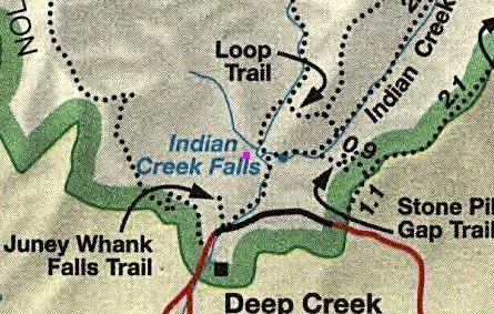
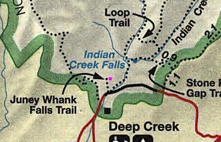
Juney Whank Falls Map
Juney Whank Falls Elevation Profile
Directions to Trailhead:
The Juney Whank Falls Trailhead is located just north of Bryson City in North Carolina. To reach the trailhead from the intersection of Rt. 441 and Rt. 19 in Cherokee, drive 10 miles south on Route 19 to Everett Street in Bryson City. Turn right onto Everett and drive for 0.2 miles, and then turn right onto Depot Street. After a short distance turn left onto Ramseur Street, and then make an immediate right onto Deep Creek Road. Drive another 2.3 miles to the Great Smoky Mountains National Park entrance, and then from there another half-mile to the parking lot for the Deep Creek Trailhead.