Kanati Fork Trail Highlights
- Trail Features
Wildflowers
- Trail Location
Between Newfound Gap and Cherokee
- Roundtrip Length
4.0 Miles
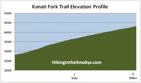
- Elevation Gain (total)
1495 Feet
- Elevation Gain (per mile)
748 Feet
- Trail Difficulty
6.99
Moderately Difficult
This moderately difficult hike is 4.0 miles roundtrip and includes 1495 feet of elevation gain.
Kanati Fork Trail Description
Over the course of the first half-mile or so, the Kanati Fork Trail traverses roughly 50 feet above the Kanati Fork Creek. During the summer months, while the leaves are on the trees, hikers will only be able to catch a few glimpses of the stream as the trail climbs the ridge. However, during the winter months, the stream will appear as a white ribbon cutting a path through the valley bottom.
Both the creek and the trail are named after the mythical Cherokee hunter, Kanati. Legend has it that Kanati, also known as "First Man," did all the hunting for his family, as well as for the entire village. Legend also says that his wife, Selu, gave the Cherokee People the gift of corn, which would become their principal crop.
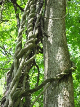
During the early portions of the hike you'll likely notice a lot of rhododendron growing adjacent to the trail, and in the valley below. As the trail meanders upward hikers will cross several small creeks as they pass under the canopy of large eastern hemlocks and yellow poplars. Although the trail climbs steadily, you really won't notice the elevation gain if you're goal is spotting wildflowers.
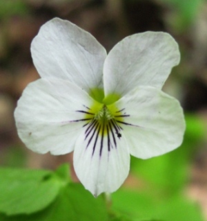
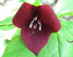
Two nights prior to our most recent hike on this trail a powerful storm ripped through the Great Smoky Mountains. Marble-sized hail dumped during the storm damaged flowers and foliage in the surrounding area. Despite the destruction we still saw a wide variety of wildflowers, including Canadian violets, Vasey's trillium, painted trillium, Northern white violets, wake robin, brook lettuce and false Solomon's seal.
Late April is usually the best time to hike the Kanati Fork Trail if you're looking for wildflowers. However, you can expect to see early yellow violets as early as March. By April you'll begin to see cut-leaved toothwort, dwarf cinquefoil, large-flowered bellwort and white baneberry.
Late summer/early fall hikers can also expect to see wildflowers along the trail, including varieties such as beaked dodder, bee balm and Turk's cap lily.
We ended this hike after walking only two miles. Hikers will have the option of continuing for another mile to reach the Thomas Ridge Trail junction; however, most of the wildflowers will be within the first two miles of the trailhead.
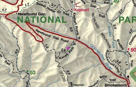
Kanati Fork Trail Map
Kanati Fork Trail Elevation Profile
Directions to Trailhead:
From the Sugarlands Visitor Center near Gatlinburg, drive 21.4 miles south along Newfound Gap Road (8 miles past Clingmans Dome Road). The parking area for the Kanati Fork Trail is easy to miss. The parking lot will be on the left side of the road; however, the trailhead is on the opposite side of the road. If you reach the Kephart Prong Trailhead you've gone a half-mile too far.
From Cherokee, drive north along Newfound Gap Road for almost 12 miles. The parking area will be on your right.