Ogle Place Highlights
- Trail Features
History / Stream
- Trail Location
Cherokee Orchard Road
- Roundtrip Length
0.8 Miles
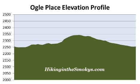
- Elevation Gain (total)
90 Feet
- Elevation Gain (per mile)
225 Feet
- Trail Difficulty
0.98
Easy
This easy hike is 0.8 miles roundtrip and includes 90 feet of elevation gain.
Ogle Place Description
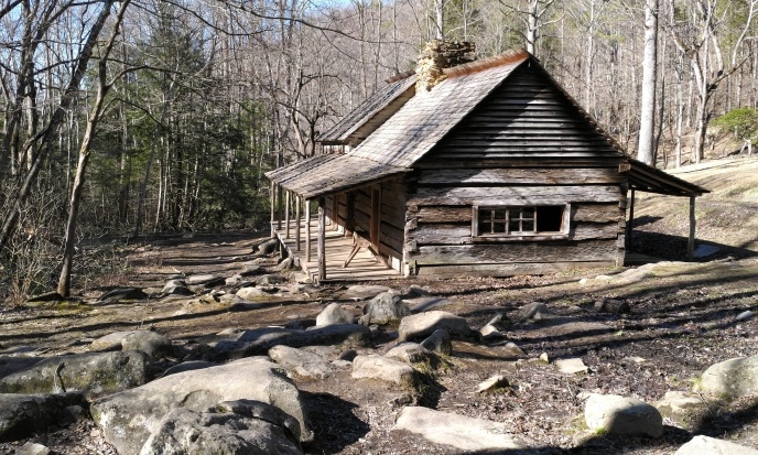
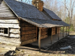
After walking only a few yards from the fairly large parking area, the short loop trail around the Ogle farmstead arrives at the Ogle Cabin. This log home was built by Noah “Bud” Ogle, a descendant of the original Ogle family that settled in White Oak Flats, now known as Gatlinburg. Arriving in the very early 1800s, the Ogle's became the first homesteaders to settle in the White Oak Flats area. Born in 1863, Noah established this 400-acre farm in 1879, and began building the house in the early 1880s. Architecturally, the cabin is known as a "saddle-bag" house, which means it consists of two houses joined by a common chimney. According to the National Register of Historic Places nomination form, this is one of the rarer floor plans used in the Smokies.
After visiting the cabin the nature trail continues in a counter-clockwise direction. You can purchase a guide at the trailhead that will help interpret the sites along the route. Just past the cabin the trail crosses over two small gurgling brooks, and then proceeds to pass through the former pastures and corn fields that were once maintained by the Ogle family. At roughly one-quarter of a mile from the trailhead hikers will reach the Twin Creeks Trail, which branches off to the right and leads back towards Gatlinburg. You should stay left at this junction to continue on the loop hike.
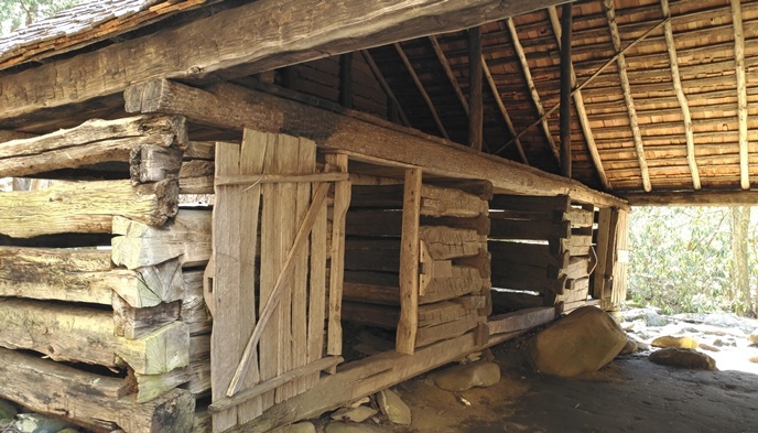
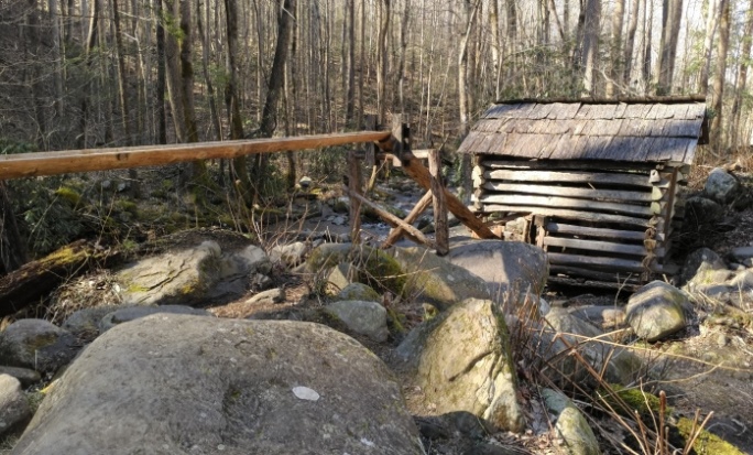
At roughly one-third of a mile hikers will arrive at the Ogle "tub" mill, which was used to grind corn into meal for the family and other settlers in the area. Built around 1885, the mill was powered by water from LeConte Creek, which was fed by an 80-foot log flume. This system which was used to generate power for the mill was fairly typical for homesteaders in the Southern Appalachians at that time.
Once past the mill the footpath begins to travel across some fairly rugged terrain as a result of the rocks and boulders strewn throughout this section of the property. Take your time as you pass through this stretch to make sure you don't wander off the trail, which can be a little challenging to follow in a couple of places.
At roughly seven-tenths of a mile you'll arrive at the Ogle barn, which was known as a "drove-through" barn because you could drive or park your wagons in the covered middle section of the barn. The barn includes four log pens that were used for livestock, such as dairy cows and draft animals. Chickens and pigs were also raised on this farm.
From the barn it's only a short walk back to the parking area. Hikers may want to note that during rainy periods portions of this trail can become quite muddy, so wearing hiking boots would be important.
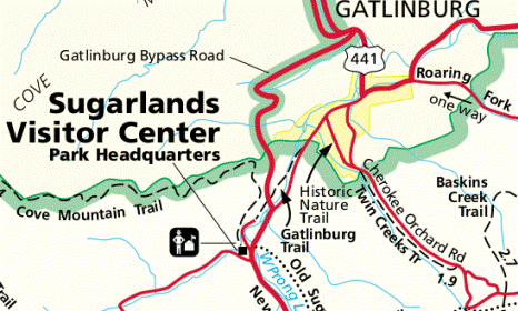
Ogle Place Map
Ogle Place Elevation Profile
Directions to Trailhead:
The hike along the Noah “Bud” Ogle Farm Self-Guiding Nature Trail in the Great Smoky Mountains begins from Cherokee Orchard Road, located just outside of Gatlinburg. Starting from Light 8 in Gatlinburg, turn onto Historic Nature Trail / Airport Road. After driving 0.7 miles veer right onto Cherokee Orchard Road, upon which you'll enter into Great Smoky Mountain National Park. After driving another 2.1 miles look for the Ogle Place on the right side of the road, located just before entering onto the one-way Cherokee Orchard Loop Road.