Schoolhouse Gap Highlights
- Trail Features
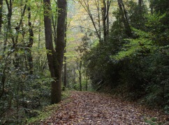
Wildflowers, Quiet Forest Hike
- Trail Location
Between Townsend and Cades Cove
- Roundtrip Length
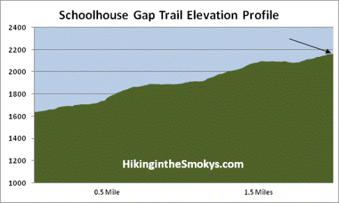
3.8 Miles
- Elevation Gain (total)
513 Feet
- Elevation Gain (per mile)
270 Feet
- Trail Difficulty
4.83
Easy
This easy hike is 3.8 miles roundtrip and includes 513 feet of elevation gain.
Schoolhouse Gap Description
The first time we hiked the Schoolhouse Gap Trail the National Park Service posted a couple of signs at the trailhead indicating that there had been bear activity on the trail, and for hikers to use caution. Interestingly, when we got to the end of the trail at the Chestnut Top Trail junction, there was a sign indicating that the Schoolhouse Gap Trail was closed due to aggressive bear activity. I write this as a reminder that no matter when or where, you are always in bear country when hiking in Great Smoky Mountains National Park. Hikers should know how to avoid bear encounters, and know what to do should you see one on the trail. The Smokies website is a good place to start.
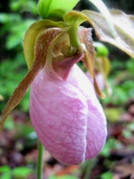
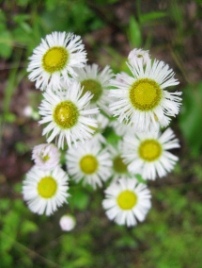
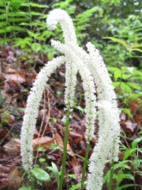
The Schoolhouse Gap Trail is an excellent hike for spring wildflowers. We saw several Virginia bluebells along the lower portions of the trail. As we proceeded higher we also saw beaked violets, pink lady's slippers, fairy wand, golden aster, star grass, red clover, Robin's plantain, sun drops, Catesby's trillium and lyre-leaf sage. The trail also had its share of rhododendron and mountain laurel, which were just beginning to bloom during our mid-May hike. During this time period hikers may also see cardinal flower, Carolina vetch and yellow ragwort along the route as well.
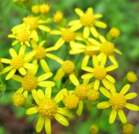
From July through October, purple ironweed, southern harebell, blue lobelia and sweet Joe Pye weed are commonly found along the trail.
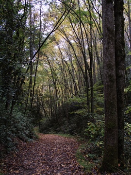
The first leg of the hike follows a small stream known as the Spence Branch. Along this stretch the trail follows a wide horse path in which three people could easily walk abreast. At just under a mile from the trailhead the Turkeypen Ridge Trail branches off to the left. Hikers should proceed straight ahead at this junction to continue on towards Schoolhouse Gap.
Hikers may notice a large boar trap at this junction. In the early 1900s a local rancher brought two dozen European wild boars to his hunting ranch, several of which eventually escaped into the mountains. Unfortunately this invasive species roots out native plants, destroys stream banks, and carries a variety of diseases that can sicken or even kill wildlife. Using traps, wildlife managers have been fighting to remove the hogs from the park over the last several decades.
Just past the Turkeypen Ridge Trail is another trail that forks off to the left. Although unmarked, this narrow path leads to the fairly well known White Oaks Sinks area. This trail will lead you first towards a beautiful meadow, before it eventually reaches a towering cliff with a cave, known as Blowhole Cave, which emits a constant flow of icy, refreshing air. There are a few confusing social trails in this area, so make sure you know exactly where you're going before deciding to venture down this path.
To continue on towards Schoolhouse Gap, hikers should proceed straight ahead here.
Just past this junction we saw a large owl. It appeared to stand about a foot in height, and had at least a three-foot wing span. I've only seen 2 or 3 owls in the wild, so this was quite a treat.
This hike ends at the Chestnut Top Trail junction, just over 1.9 miles from the trailhead. You can continue on for another two-tenths of a mile to Schoolhouse Gap, which will take you to Schoolhouse Gap Road just outside of the park boundary.
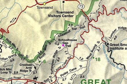
Schoolhouse Gap Map
Schoolhouse Gap Elevation Profile
Directions to Trailhead:
This hike to Schoolhouse Gap in the Great Smoky Mountains begins from Laurel Creek Road. To reach the trailhead from the Townsend "Y" junction, drive west on Laurel Creek Road towards Cades Cove. The parking area for the Schoolhouse Gap Trailhead is located on your right, roughly 3.7 miles from the Townsend "Y" junction.