Toms Branch Falls Highlights
- Trail Features
Waterfalls
- Trail Location
Deep Creek
- Roundtrip Length
0.6 Miles
- Elevation Gain (total)
47 Feet
- Elevation Gain (per mile)
157 Feet
- Trail Difficulty
0.69
Easy
This easy hike is 0.6 miles roundtrip and includes 47 feet of elevation gain.
Toms Branch Falls Description
Toms Branch Falls is accessed via the Deep Creek Trail, which was one of the first trails constructed by the Civilian Conservation Corps in the newly legislated national park in the early 1930s. The current Deep Creek Campground also served as the site for the Deep Creek Civilian Conservation Corps Camp from 1933 to 1936.
In 1910 Horace Kephart, author of Our Southern Highlanders, and a strong proponent of national park status for the Great Smoky Mountains, lived for a short time with the Bob Barnett family in one of the last houses along the upper portions of Deep Creek. Until his early death, as a result of an auto accident in 1931, Kephart also used the old Bryson Place as his summertime camping spot. A historical marker near Backcountry Campsite 57, located just north of the junction between the Deep Creek Trail and Martins Gap Trail, now commemorates the site.
The trail begins as a wide path as it traces Deep Creek upstream. The 80-foot Toms Branch Falls is located only three-tenths of a mile from the trailhead. The park service has provided several benches for visitors to admire these beautiful falls, which spill down into the creek from the opposite bank.
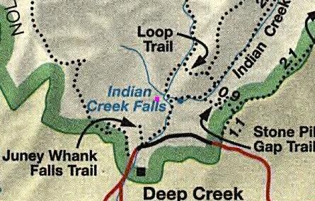
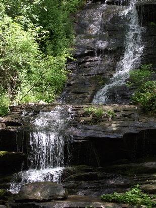
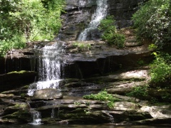
If you wish to explore more of the area, you will have the option of continuing along this same trail for another six-tenths of a mile to visit the 45-foot Indian Creek Falls.
As another option, Juney Whank Falls is also located in this area, and can be reached via a short half-mile hike from the same parking lot.
Hikers may want to note that bicycles are allowed on the Deep Creek and Indian Creek trails to the points where the old roadbeds end. The Gatlinburg Trail and the Oconaluftee River Trail are the only other trails in the park where bicycles are permitted.
Toms Branch Falls Map
Toms Branch Falls Elevation Profile

Directions to Trailhead:
The hike to Toms Branch Falls in the Great Smoky Mountains begins from the Deep Creek Trailhead, located just north of Bryson City, North Carolina. To reach the trailhead from the intersection of Rt. 441 and Rt. 19 in Cherokee, drive 10 miles south on Route 19 to Everett Street in Bryson City. Turn right onto Everett and drive for 0.2 miles, and then turn right onto Depot Street. After a short distance turn left onto Ramseur Street, and then make an immediate right onto Deep Creek Road. Drive another 2.3 miles to the park entrance, and then from there another half-mile to the parking area for the Deep Creek Trailhead.