West Prong Trail Highlights
- Trail Features
Quiet Forest Hike, Stream
- Trail Location
Tremont
- Roundtrip Length
5.4 Miles
- Elevation Gain (total)
1375 Feet
- Elevation Gain (per mile)
509 Feet
- Trail Difficulty
8.15
Moderately Difficult
This moderately difficult hike is 5.4 miles roundtrip and includes 1375 feet of elevation gain.
West Prong Trail Description
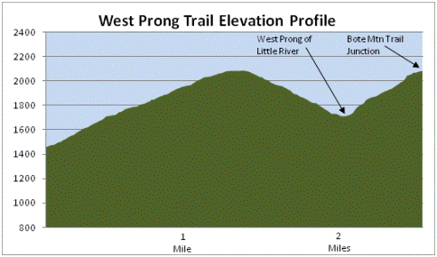
The West Prong Trail begins as a steady climb, ascending roughly 625 feet over the course of the first 1.4 miles, before descending towards the West Prong of the Little River.
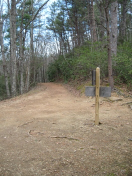
At roughly three-tenths of a mile from the trailhead you'll reach a somewhat confusing trail sign at the junction of an unmarked spur trail. Stay left here to continue on the West Prong Trail (heading towards Campsite 18). The side trail heading downhill leads to an old cemetery that's still in use by the families who once lived in this area.
This first section of the hike is very peaceful and quiet as it climbs along the northern slopes of Fodderstack Mountain. However, once the trail begins descending, the rush of the stream in the valley below becomes progressively louder.
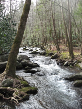
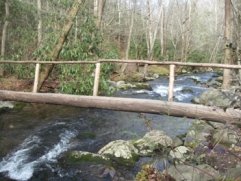
At roughly 2 miles from the trailhead you'll reach a creek crossing without a footbridge - only a few rocks and logs. If your balance isn't all that steady you may want to consider bringing a pair of trekking poles with you, or you could simply find a pair of stout sticks if the flow of the creek requires some assistance with balance.
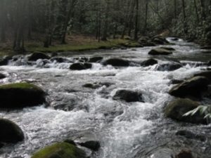
Just beyond the creek crossing, sitting adjacent to the West Prong of the Little River, is Backcountry Campsite 18. The three campsites located here offer an outstanding place to spend a night or two under the stars. There are several large logs and boulders in and around the stream that make this a great place for a picnic lunch. The West Prong is also a popular stream for rainbow trout fishermen.
To continue on towards the Bote Mountain Trail you'll have to cross the footbridge located in the middle of the campground. As a result of there being campsites on either side of the stream, it can be a little difficult in trying to determine in which direction the trail proceeds after crossing the bridge. However, hikers should head towards the right after crossing over to the other side. After walking about 30 feet or so you'll easily pick up the main trail again as it heads up the hillside.
At 2.7 miles hikers will arrive at the Bote Mountain Trail junction. Almost immediately you'll notice that the Bote Mountain Trail is a very wide path. This portion of the trail was once used as a roadway by the Civilian Conservation Corp in the 1930s. On our most recent hike we could see the snowy summit of Thunderhead Mountain through the trees from this broad intersection.
The Bote Mountain Trail junction marks the end of this hike description, however, you'll have a couple of choices if you wish to extend your hike. A turn to the right here would lead you to Laurel Creek Road in roughly 1.2 miles, while a turn to the left would take you up to the Appalachian Trail at Spence Field, roughly 5.7 miles away.
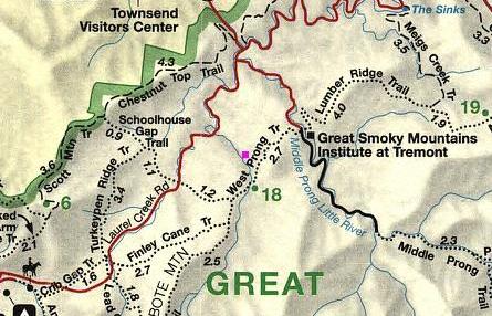
West Prong Trail Map
West Prong Trail Elevation Profile
Directions to Trailhead:
From the Townsend "Y" intersection, drive west on Laurel Creek Road towards Cades Cove. Roughly two-tenths of a mile from the "Y", turn left to proceed towards the Great Smoky Mountains Institute at Tremont. Drive another two miles and turn right into the parking area for the West Prong Trail, located just before reaching the Institute.