Spruce Flats Falls Highlights
- Trail Features
Waterfall
- Trail Location
Tremont
- Roundtrip Length
1.4 Miles
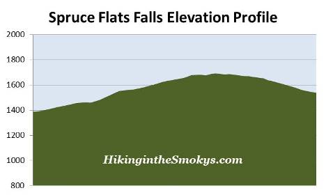
- Elevation Gain (total)
460 Feet
- Elevation Gain (per mile)
657 Feet
- Trail Difficulty
2.32
Easy
This easy hike is 1.4 miles roundtrip and includes 460 feet of elevation gain.
Spruce Flats Falls Description
From the parking area hikers should walk up the gravel road and turn left just before reaching the GSMIT dormitory building. The trailhead is located only a few yards from the building.
Tremont, located in the Walker Valley, is named after the small lumber town that developed when the Little River Lumber Company used this area as a base of operations. The name is derived from the combination of "tree" and "mountain."
Tremont was one of the last areas in the park to be logged. This was a result of Will Walker's refusal to sell his property to the Little River Lumber Company. However, after a stroke that left him largely incapacitated, Walker was forced to finally sell his property in 1918. Logging operations would continue in the valley until 1938 - four years after the formation of the Great Smoky Mountains as a national park. This was permitted as a result of Colonel Wilson B. Townsend selling his Little River tract to the Great Smoky Mountains National Park Commission in 1926, in exchange for an agreement that allowed him to continue logging in the area for another 15 years.
Roughly 20 yards from the trailhead hikers will reach the Buckeye Trail junction. The Lumber Ridge Trail continues for another 4 miles to Buckhorn Gap and the intersection of the Meigs Creek and Meigs Mountain trails. To continue towards Spruce Flats Falls hikers should turn right onto the Buckeye Trail. Neither the waterfall nor this spur trail appears on the official park map. Despite being an unofficial trail the route is well defined and very easy to follow. There are a couple of sections, however, where the path becomes very rugged due to rocks and roots.
From the junction the Buckeye Trail leads steeply uphill, and soon begins to travel above a series of tent cabins that are used by overnight guests of the institute. At just under two-tenths of a mile you’ll reach another split in the trail. To proceed towards the falls you should turn left here and continue up the hill. Immediately past the split the trail passes an old cistern. Above the cistern you’ll reach a nice perch that offers decent views of Upper Tremont Road below, as well as Bote Mountain and Thunderhead Mountain towards the southwest.
At just under a half-mile the trail reaches its highest point, and soon begins descending towards the falls. As you descend the trail becomes progressively steeper and more rugged, especially as you get closer to the falls. At roughly seven-tenths of a mile hikers will finally reach Spruce Flats Falls.
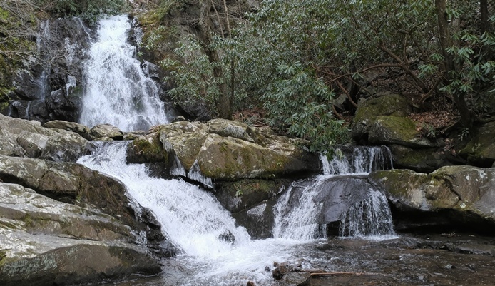
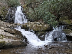
Despite not being on the official park map, the falls receives a fair amount of visitors. And for good reason. This is an especially scenic waterfall, and one of the most picturesque in the park, in my opinion. The waterfall tumbles down the hill in four separate tiers, with a total drop of roughly 30 feet. After landing in a nice size pool at the bottom of the falls, Spruce Flats Branch continues for a short distance before spilling into the Middle Prong of the Little River near Upper Tremont Road.
Spruce Flats Falls Map
Spruce Flats Falls Elevation Profile
Directions to Trailhead:
The hike to Spruce Flats Falls in the Great Smoky Mountains begins from the Lumber Ridge Trailhead in Tremont. To reach the trailhead from the Townsend "Y" intersection, drive west on Laurel Creek Road towards Cades Cove. Roughly two-tenths of a mile from the "Y", turn left to proceed towards the Great Smoky Mountains Institute at Tremont. Drive another two miles and turn left into the Great Smoky Mountains Institute. After driving across the narrow bridge, look for a small parking area on the right. The Lumber Ridge Trailhead is located along the gravel road just beyond the parking area.