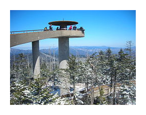
The Mountain-to-Sea Trail in Great Smoky Mountains National Park
The Mountains-to-Sea Trail stretches roughly 1,150 miles from Clingmans Dome in the Great Smoky Mountains, to Jockey's Ridge on the Outer Banks of the North Carolina coast. Although only 672 miles of the footpath are actually built right now, adventurers can still hike across the state using temporary connectors on back roads and state bike routes.
The Mountains-to-Sea Trail (MST) was built to showcase North Carolina's diverse landscape. Thru-hikers will experience mountains, rugged gorges, small Piedmont farms, coastal swamps, colonial towns, and barrier islands as they make their way across the Tar Heel State. It climbs both the tallest mountain peak and the highest sand dune in the Eastern United States, passes through three national parks, two national wildlife refuges, three national forests, seven state parks and visits three lighthouses, including the nations tallest.
 The first section of trail, located in Great Smoky Mountains National Park, runs for more than 58 miles: from Clingmans Dome - the highest point in the Park, to Black Camp Gap near the Blue Ridge Parkway. From Clingmans Dome the MST follows the crest of the Smokies along the Appalachian Trail before descending down the Fork Ridge and Deep Creek trails. The trail then begins climbing again, taking hikers over Thomas Divide to Newton Bald, before descending once again down to the Smokemont Campground.
From Smokemont the trail travels up the Bradley Fork and Chasteen Creek trails, over to Beech Gap and Pin Oak Gap, before traveling south along the Balsam Mountain Road to reach Black Camp Gap on Heintooga Ridge Road.
Hikers should note that the route through the Smokies has changed a couple of times over the last couple of years, and could change again in the future. However, below are some of the current routing details, as of January 2015, for the MST in the Great Smoky Mountains:
| Location | Incremental Mileage | Cumulative Mileage | Elevation |
|---|---|---|---|
| Clingmans Dome / MST Trailhead | 0.0 | 0.0 | 6643 |
| Fork Ridge Trail junction | 4 | 4 | 5888 |
| Deep Creek Trail junction / Campsite 53 | 5.1 | 9.1 | 3060 |
| Campsite 54 | 2.6 | 11.70 | 2600 |
| Campsite 55 | 0.8 | 12.5 | 2410 |
| Pole Road Creek Trail junction | 0.1 | 12.6 | 2459 |
| Campsite 56 | 0.2 | 12.8 | 2405 |
| Martins Gap Trail Jct. / Campsite 57 | 0.5 | 13.3 | 2400 |
| Sunkota Ridge Trail junction | 1.5 | 14.8 | 3394 |
| Thomas Divide Trail junction | 4.9 | 19.7 | 4765 |
| Newton Bald Trail junction | 0.5 | 20.2 | 4959 |
| Campsite 52 | 0.1 | 20.3 | 5000 |
| Newfound Gap Road | 5.2 | 25.5 | 2184 |
| Bradley Fork Trailhead | 0.1 | 25.6 | 2180 |
| Chasteen Creek Trail junction | 1.6 | 27.2 | 2300 |
| Campsite 50 | 0.1 | 27.3 | 2360 |
| Campsite 48 | 2.2 | 29.5 | 3320 |
| Hughes Ridge Trail junction | 1.7 | 31.2 | 4700 |
| Enloe Creek Trail junction | 0.5 | 31.7 | 4800 |
| Campsite 47 | 1 | 32.7 | 3620 |
| Hyatt Ridge Trail junction | 2.6 | 35.3 | 4400 |
| Beech Gap Trail II trailhead | 1.7 | 37 | 4900 |
| Straight Fork Road | 2.8 | 39.8 | 3100 |
| Beech Gap Trail I trailhead | 0.1 | 39.9 | 3100 |
| Balsam Mountain Trail junction | 2.4 | 42.3 | 5069 |
| Balsam Mountain at Pin Oak Gap | 2.3 | 44.6 | 4424 |
| pass Palmer Creek Trailhead | 0.7 | 45.3 | 4508 |
| pass Spruce Mountain Trailhead | 1.8 | 47.1 | 4802 |
| Balsam Mountain Campground | 6.5 | 53.6 | 5330 |
| pass Polls Gap | 2.4 | 56 | 5127 |
| Black Camp Gap Parking Area | 2.4 | 58.4 | 4490 |
Additional Resources:
Additional Resources:
Great Smoky Mountains National Park requires all backpackers to stay in designated campsites and shelters while camping in the backcountry. The park now requires a permit and advance reservations for all backcountry camping as well. As of 2013 the national park began charging a fee to camp in the backcountry. For additional information on reserving a campsite or shelter, please click here. For more general information on camping in the Smokies, please click here.
For more information on the Mountains-to-Sea Trail, please click here.
National Geographic Trails Illustrated Map for the Smoky Mountains
Sectional Maps (more details): Western Smokies / Eastern Smokies
Backcountry Rules and Regulations for the Smokies
Campsite and Shelter information (GPS waypoints, maps, etc.)
Temporary road, campsite and shelter closures, and water issues
Local Climate and Weather
Appalachian Trail Shuttle Services
The Mountains-to-Sea Trail Across North Carolina