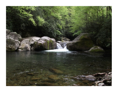
Benton MacKaye Trail in Great Smoky Mountains National Park
The Benton MacKaye Trail travels through some of the most remote and beautiful backcountry in Georgia, Tennessee and North Carolina. From Springer Mountain in Georgia, to Davenport Gap in the northeastern corner of Great Smoky Mountains National Park, the trail runs for nearly 300 miles. Along the way it passes through eight federally designated Wilderness and Wilderness Study Areas.
The trail is named for Benton MacKaye, the forester, conservationist, and co-founder of the Wilderness Society who originally envisioned this route for the Appalachian Trail. In 1979 the Benton MacKaye Trail Association was organized to build and maintain MacKaye's chosen route along the western crest of the Blue Ridge Mountains. Twenty-six years later, on July 16th, 2005, the Benton MacKaye Trail (BMT) was officially opened during a ceremony at Mud Gap, just southwest of the Smokies.
 The BMT enters the Great Smoky Mountains at the Twentymile Ranger Station on the southwestern corner of the Park. It quickly rises to cross the Appalachian Trail near the Shuckstack Fire Tower before descending again to the shores of Fontana Lake. After following the lake for more than 27 miles the trail begins to climb again, eventually passing over Noland Divide and Newton Bald, before making a quick descent back down to the Smokemont Campground. From the campground the trail begins climbing once more, first taking hikers past Chasteen Creek Cascade on its way up to Hyatt Ridge. The trail then briefly drops down to Beech Gap before making the long climb up to Balsam High Top, and then onto the highest point along the entire trail at 5842-foot Mt. Sterling. From there the trail makes a sharp descent down to Big Creek, before eventually meeting up again with the Appalachian Trail at Davenport Gap.
Within the Park, the total mileage for the BMT is roughly 97 miles. The trail is marked with a white diamond trail marker with the words "Benton MacKaye Trail" on a green background.
There are only 5 access points for the trail in the Smokies: Twentymile Ranger Station, Lakeview Drive (a.k.a. the Road to Nowhere), US 441 / Smokemont Campground, Straight Fork Road, and at Big Creek/Davenport Gap.
Below are some routing details for the BMT in the Great Smoky Mountains:
| Location | Incremental Mileage | Cumulative Mileage | Elevation |
|---|---|---|---|
| 20 Mile Ranger Station / Enter Park | 0.0 | 0.0 | 1334 |
| Wolf Ridge Trail Jct | 0.5 | 0.5 | 1459 |
| Campsite 93 | 1.2 | 1.7 | 1850 |
| Long Hungry Trail Jct | 1.4 | 3.10 | 2363 |
| Lost Cove Trail Jct. / Sassafras Gap | 1.9 | 5 | 3600 |
| Campsite 91 | 2 | 7 | 2030 |
| Lakeshore Trail Jct | 0.7 | 7.7 | 1839 |
| Campsite 90 | 0.5 | 8.2 | 1760 |
| Eagle Creek Trail | 0.5 | 8.7 | 1734 |
| Campsite 88 | 3 | 11.7 | 1950 |
| Campsite 86 | 1 | 12.7 | 1680 |
| Hazel Creek Trail | 0.4 | 13.1 | 1700 |
| Campsite 81 | 3.5 | 16.6 | 1800 |
| Campsite 77 | 4.2 | 20.8 | 1800 |
| Campsite 76 | 4.6 | 25.4 | 1770 |
| Campsite 98 | 2.5 | 27.9 | 1720 |
| Campsite 74 | 6.5 | 34.4 | 1720 |
| Whiteoak Branch Trail | 1 | 35.4 | 2012 |
| Goldmine Loop | 1.2 | 36.6 | 2144 |
| Tunnel Bypass Trail | 0.1 | 36.7 | 2160 |
| Tunnel | 0.3 | 37 | 2320 |
| Lakeview Drive | 0.3 | 37.3 | 2079 |
| Noland Creek Trail Jct | 0.5 | 37.8 | 1800 |
| Campsite 65 | 1.3 | 39.1 | 2040 |
| Campsite 64 | 2.8 | 41.9 | 2540 |
| Campsite 63 | 1.4 | 43.3 | 2920 |
| Campsite 62 | 1.3 | 44.6 | 3160 |
| Campsite 61 | 1.5 | 46.1 | 3560 |
| Pole Creek Road Jct | 1 | 47.1 | 4243 |
| Deep Creek Trail Jct | 3.3 | 50.4 | 2459 |
| Campsite 56 | 0.3 | 50.7 | 2405 |
| Martins Gap Trail Jct. Camp 57 | 0.4 | 51.1 | 2400 |
| Sunkota Ridge Trail Jct | 1.5 | 52.6 | 3394 |
| Thomas Divide Trail Jct | 4.9 | 57.5 | 4765 |
| Newton Bald Trail Jct | 0.4 | 57.9 | 4959 |
| Campsite 52 | 0.1 | 58 | 5000 |
| Newfound Gap Road Jct | 5.2 | 63.2 | 2184 |
| Smokemont Campground | 0.3 | 63.5 | 2180 |
| Bradley Fork Trail Jct | 0.3 | 63.8 | 2180 |
| Chasteen Creek Trail Jct | 2.2 | 66 | 2300 |
| Campsite 50 | 0.1 | 66.1 | 2360 |
| Campsite 48 | 2 | 68.1 | 3320 |
| Hughes Ridge Trail Jct | 1.9 | 70 | 4700 |
| Enloe Creek Trail Jct | 0.4 | 70.4 | 4800 |
| Campsite 47 | 2.5 | 72.9 | 3620 |
| Hyatt Ridge Trail Jct | 1.1 | 74 | 4400 |
| Beech Gap Trail Jct | 1.7 | 75.7 | 4900 |
| Straight Fork Road Jct | 2.8 | 78.5 | 3100 |
| Beech Gap Trail Jct | 0.3 | 78.8 | 3100 |
| Balsam Mt. Trail Jct | 2.5 | 81.3 | 5069 |
| Laurel Gap Shelter | 1.7 | 83 | 5490 |
| Mt. Sterling Ridge Trail Jct | 0.3 | 83.3 | 5500 |
| Mt. Sterling Trail Jct | 5.3 | 88.6 | 5679 |
| Baxter Creek Trail Jct. Camp 38 | 0.3 | 88.9 | 5820 |
| Big Creek Road Jct / Big Cr Campground | 6.1 | 95 | 1700 |
| Davenport Gap / Exit Nat'l Park | 1.8 | 96.8 | 2000 |
Additional Resources:
Great Smoky Mountains National Park requires all backpackers to stay in designated campsites and shelters while camping in the backcountry. The park now requires a permit and advance reservations for all backcountry camping as well. As of 2013 the national park began charging a fee to camp in the backcountry. For additional information on reserving a campsite or shelter, please click here. For more general information on camping in the Smokies, please click here.
For more information on the Benton MacKaye Trail, please click here.
The BMT can be combined with the Appalachian Trail in the Smokies to make several long loop hikes. You can click here for more information on hiking the A.T. in the Smokies.
National Geographic Trails Illustrated Map for the Smoky Mountains
Sectional Maps: Western Smokies / Eastern Smokies
Backcountry Rules and Regulations for the Smokies
Campsite and Shelter information (GPS waypoints, maps, etc.)
Temporary road, campsite and shelter closures, and water issues
Appalachian Trail Shuttle Services